4 Days Rwenzori Mountain Trekk Kasese in Uganda.
We allow 1 day of travel to Kasese and the whole drive will take us about 8hrs through the Kampala - fortportal - Kasese highway, we shall do some shopping and get ready for the 5-days trekk of the Rwenzori mountain.
We spend our night at The white house Hotel in Kasese town or Trekkers hostel in Kyanjiki.
Four Day Trek itinerary to - Rwenzori Mountains National Park.
The trek starts at Trekkers Hostel in Kyanjiki 12 kilometres from Kasese past Kilembe, the road is new tarmac except for the last kilometres making the base camp easily accessible. Best to start trekking by 8.30am but can leave as late as 10am. Meet your guides and briefing. You walk 2.2km to the UWA rangers post at 1,727 metres.
Here the rangers brief you on the day's activities and rules of the National Park.
Today's walk 8.6 km expected time 5 to 7 hours Start height at Trekkers base camp is 1,450 metres climbing to 3,171 metres.
The first two kilometres climbs steadly through prestine montane forest, with tall trees thick undergrowth and a multitude of different species of birds and primates. Then a fairly strenuous climb up a main ridge with few rocks and firm footing except immediately after a heavy downpour or within the bamboo zone, climbing to your first night at Samalira Camp. As you leave the rangers post you walk along a path through tall grassland and ferns which gives way to magnificent pristine forests.
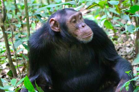
The forests are untouched and there is a wide variety of trees and plants. Many species of birds can be heard and seen in this rich environment. The first few kilometres climb steadily crossing several small streams and rivers then we start climbing the ridge. As we climb the trees become taller and straighter and it is common to see and hear many types of primates, on the left you may hear troupes of chimpanzee echoing around the valleys. Particularly around our lunch spot at 2,570m If you are lucky, it is possible to see troupes of 15 to 20 black and white Colobus monkeys or smaller groups of Blue monkeys as they dash through the trees. Lunch is fresh fruit, salad and chicken rolls, and a cup of tea/coffee, or fruit juice.
After lunch we continue to climb steadily passing a small rock shelter (2,785m) previously used by poachers to hunt primates and dika (small antelope) immediately above this small cave the bamboo zone starts and the trail becomes steeper and at times boggy. As we near the top we break out of the bamboo the vegetation changes to Giant Heather with long lichen or moss hanging from the branches and the path becomes less steep. Through open spaces in the vegetation you get fantastic views of the valleys and hills below looking across to Lake George and Queen Elizabeth National Park in the distance. The equator lies about 30kms south of where you are. Samalira Camp is at 3,147 metres, meaning lookout and offers great views of the surrounding landscape and Kasese town. (Mobile network available at this camp)
After a hearty breakfast we commence walking at 8.15 and about 500 metres from camp cross a small stream after which the climb becomes steep for about 200 metres up a narrow moss covered ridge. The thick moss covering the ground and rocks under the giant heather trees is spectacular with a carpet of deep green covering the rocky ridge. We ask you to help preserve this prestine environment by keeping to the pathway and avoid damaging the moss. The views give us the impression that we could fly as we look across the many ridges and valleys far below.
You can see Kilembe village deep in the valley and across Lake George. After a relatively short climb the trail becomes less steep but muddy as we pass over Chavumba (meaning heaven) at 3,316m them cross a small flat valley to climb up a steady ridge through a thick forest of moss covered trees which to say the least is impressive. The trail continues to the top of the ridge at 3,515 metres. Here we descend steadily for about one kilometre to a rest point before descending a steep drop into the Nyamwamba valley and a well earned lunch break at Poly's Rock Shelter 3,249 metres. Poly was a poacher who lived in this rock shelter for more than ten years hunting duiker (small deer like antelope) monkeys, birds and anything else he could sell as meat.
After lunch we climb steadily above the Nyamwamba River for 2.6km firstly though old giant heathers covered in old man's beard moss then at the head of the valley you climb a steep pinch and weave your way though a field of huge boulders. Due to the high rainfall and swirling mists/fog the rocks are covered in deep green moss setting an erie atmosphere but there origin is that they were pushed ahead of enormous glaciers which carved out the deep valleys millions of years age and when these glaciers finally came to rest they melted leaving a huge pile of rocks in front of them and where they settled left a flat bog which is now covered in clusters of grass. these bogs are usually hard walking and boggy as you walk over a bed of deep peat or plant material several feet deep.
After the bog you climb a short distance to Kiharo Camp at 3,588 metres which is situated directly at the base of granite cliffs of 20 to 40 metres, with towering peaks above. Some people may want to climb one to the short cliff faces near the camp to fill in the afternoon hours. Again the camp is in 12x20 6 person tents with a 10 foot annex where you may sit a relax. The environment here is fantastic as where ever you look there are cliffs towering above as the camp is set in a narrow valley with a fast flowing river on one side.
we back track past Polys shelther climb up to the main ridge 3,515 metres where we take the path to the south which crosses to the trail coming down from Mutinda to Kalalama Camp. After meeting the trail we desend down to Kalalama Camp 3,134 metres where we prepare our evening meals while overlooking Kasese and Lake George from a different perspective. The the south is the rugged cliff faces of Rwatamaguta and Karasimbi rising far above us and creating the wonder of the persity of the Rwenzori Mountains
Here the bamboo zone is wet and boggy particularly after rain as the bamboo shedding large volumes of leaves which retains moisture. The trail is on the southern, windward side of the mountain and gets more rain. At around 2,600 metres the bamboo gives way to afro montane forests as we pass just above Sine Rock Shelter. This rock shelter was the home to a gentleman called Sine who spent over thirty years in the mountains poaching animals.
As we reach the bottom of the ridge we cross a rather large fast flowing stem and on the Musenge rock shelter. Here we have lunch and a short break before we walk the final 6 km through thick mountain montane forest to the Rangers Post 1,727 metres. After a short debriefing, we sign off and walk down to Trekkers Hostel.
If you are strong enough,you will get back in time and drive back to Kampala,arriving late at 7:30pm.
For detailed and more tailor made itineraries, feel free to contact us at tours@adventure-travellers.com


Most Popular Uganda Safaris
© 2026 African Adventure Travellers. All Rights Reserved.