Rwenzori Mountains - Uganda.
Rwenzori Mountains is located in south western Uganda in Kasese comprising of Mount Stanley with 5,109m high as the highest peak, Mount Speke 4,890m high, Mount Baker 4,843m high, Mount Emin 4,798m high, Mount Gessi 4,715m high, and Mount Luigi di Savoia 4,627m high. Mount Stanley is the largest with many summits and Margherita peak being the highest point.

The Rwenzori mountains ranges is pided by the Uganda - Congo boundary going through the highest peak of Mt.Stanley. The Mountain in Uganda is protected by the the Rwenzori Mountain National Park and protected by the Virunga National park in the DRC Congo. The mountain can be hiked in a 7-day's trail that goes along the Mobuku and Bujuku valleys beneath the highest peaks.
Hiking circuits on Rwenzori Mountains.
- 3 nights 4 days to John Mate hut.
- 4 nights 5 days to Bujuku Hut.
- Margherita peak 7 nights 8 days.
The 7 days central circuit on Rwenzori Mountains.
Day 1 on Rwenzori Mountains: Nyakalengija (1615m) - Nyabitaba Hut (2651m)
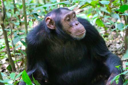
The Central Circuit starts at the RMS offices at Nyakalengija. You should arrive in the morning to allow ample time to rent equipment and meet your guides and porters. The trail begins by passing through farmland to the park boundary beyond which it follows the Mubuku river, crossing its Mahoma tributary before starting a long, steep climb up onto a massive ridge to reach Nyabitaba hut. The hike takes around 5 hours. During this part of the trip you may hear chimpanzee and see black and white colobus, blue monkey and the brilliantly coloured Rwenzori turaco.
Day 2 on Rwenzori Mountains: Nyabitaba (2651m) - Mubuku River (2600m) John Matte Hut.(3505m)
This involves a demanding 7+ hour trek up to John Matte hut. The Central Circuit ‘proper’ starts a few hundred metres beyond Nyabitaba where the trail pides. The right fork leads to the peaks up the Bujuku valley while the path on the left is used for the subsequent descent. The trail leads to the Kurt Shafer Bridge which crosses the Mubuku valley just below the river’s confluence with the Bujuku valley. Beyond the river, a muddy, slippery trail climbs steadily up through bamboo forest. After a five hour trek is the start of the giant lobelia and groundsel zone, a vegetation type limited to East Africa’s highest mountains. He final hour’s walk to John Matte hut passes through a challenging bog full of extraordinary plants.
Day 3 on Rwenzori Mountains: John Matte (3505m) to Bujuku (3962m).
The route fords the Bujuku River as you cross the Lower Bigo bog, A steep climb follows to reach the Upper Bigo Bog where a boardwalk has been constructed to assist walkers. In clear weather, there are superb views of Mt. Stanley at the head of this cavernous, glacier-carved valley. Above the bog, after a long steady climb over glacial moraine, criss-crossing the river, the trail reaches the lovely Lake Bujuku. The last stage of the 3-5 hour hike to Bujuku Hut past Cooking Pot Cave is perhaps the muddiest stage of the expedition. The hut is well placed for parties climbing Mt. Speke.
Day 4 on Rwenzori Mountains: Bujuku (3962m) - Scott Elliott Pass (4372m) Kitandara (4023m).
From Bujuku hut, the trail crosses more mud before climbing steeply through a forest of giant groundsels, climbing a short metal ladder to ascend the Groundsel Gully. Above the gully, a branch in the trail climbs directly to Elena Hut (4430m) for the ascent of Margherita peak on Mt. Stanley (5109m). This climb needs an ice axe, mountain boots, crampons and ropes.
The main trail continues up a steep screen slope over Scott Elliot pass, the highest point on the circuit. The pass provides fabulous views back down the Bujuku valley and of Mts. Stanley and Baker towering above. Beyond the pass, the route runs downhill beneath the massive cliffs of Mt. Baker. After passing Upper Lake Kitandara, the 3-5 hour hike ends at the hut beside Lower Lake Kitandara, a beautiful site surrounded by towering peaks.
Day 5 on Rwenzori Mountains: Kitandara (4023m) - Freshfield Pass (4282m) - Guy.
Yeoman (3505m) Fresh field is a long flat traverse through tracts of fabulously colourful moss (and more mud), beyond which the long descent to Nyakalengija begins. The hike to Guy Yeoman hut takes around 5 hours. The hut enjoys a lovely location close to the Mubuku River with terrific views of the looming Mt. Baker to the north.
Day 6/7 on Rwenzori Mountains: Guy Yeoman (3505m) - Nyabitaba (2651m).
The descent to Nyabitaba takes around 5 hours but with an early start it is possible to make it all the way down to Nyakalengija. Below Guy Yeoman, the route descends the cliffs of Kichuchu. Beyond Kichuchu the muddy path crosses the Mubuku River twice before climbing upwards to Nyabitaba to complete the circuit.
Day 7 on Rwenzori Mountains: Nyabitaba (2651m) - Nyakalengija (1615m).
Descending from Nyabitaba to Nyakalengija will take 2-3 hours.


Most Popular Uganda Safaris
© 2026 African Adventure Travellers. All Rights Reserved.